One Platform. Exact 3D Models for Photovoltaic, Construction and Terrains
Replace low-res guesswork with engineering-grade 1:1 digital twins. Get 99.9% accurate, DIN-standard measurements for PV and Construction in just 2 hours. With 9x more precision than satellite imagery, Render-a provides the professional data you need to eliminate site errors instantly.
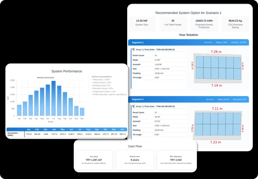
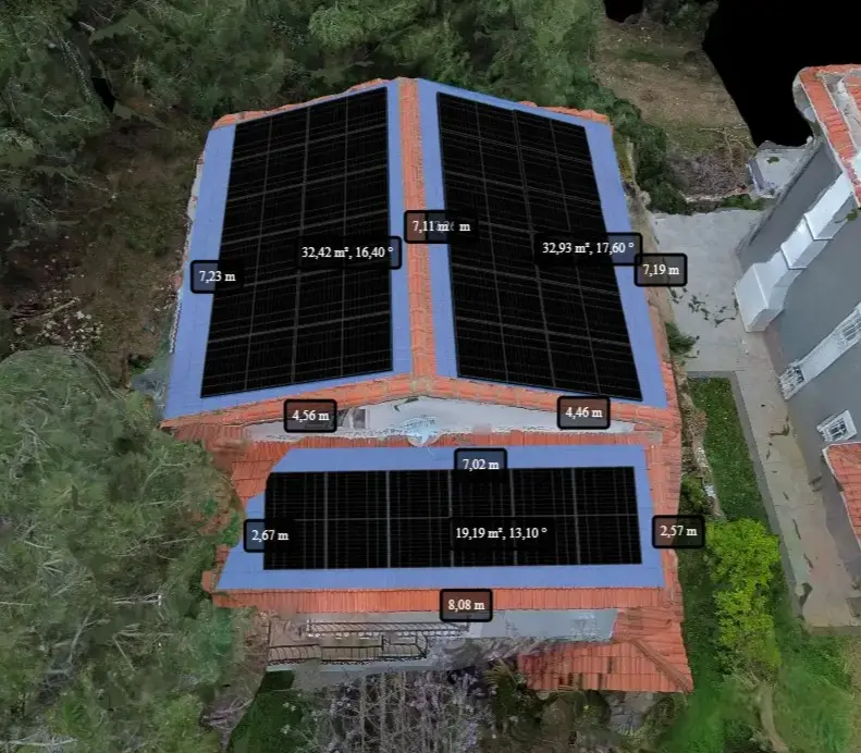
High-Precision PV & Roofing
Transform drone data into 99.9% accurate 1:1 digital twins with a 2-hour render time, ensuring every solar panel fits perfectly without a single site revisit.
Scaffolding & Facade Measurement
0% measurement errors. Capture centimeter-precise facade dimensions safely from the ground. No laser, no tape , just exact 3D models for reliable scaffolding calculation and material orders.
Advanced Terrain & Site Measurement
9x more detail than satellite maps. Identify every slope and obstacle instantly. Gain absolute engineering certainty for large-scale projects and hard-to-reach areas without leaving your office.
Engineering-Grade Reports & Industry-Ready Exports
Data-driven project approvals. Instantly generate energy yield estimates, carbon footprint reports, and certified survey sets. Deliver professional, bank-ready technical documentation seamlessly integrated with Eturnity, PVSOL, Pvsyst and AutoCAD.