

ROOF MEASUREMENT AND SOLAR PLANNING
Roof measurement software, built on your own drone imagery
- Start with your own drone imagery
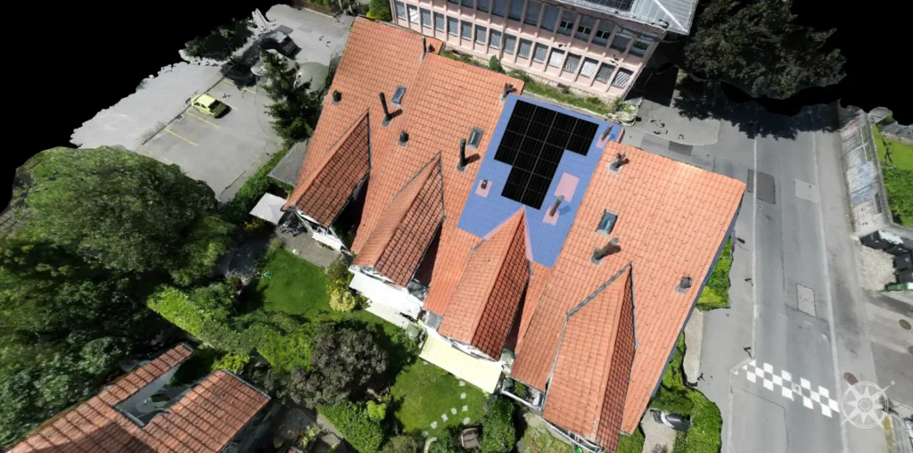 Drone photo
Measurable 3D model
Drone photo
Measurable 3D model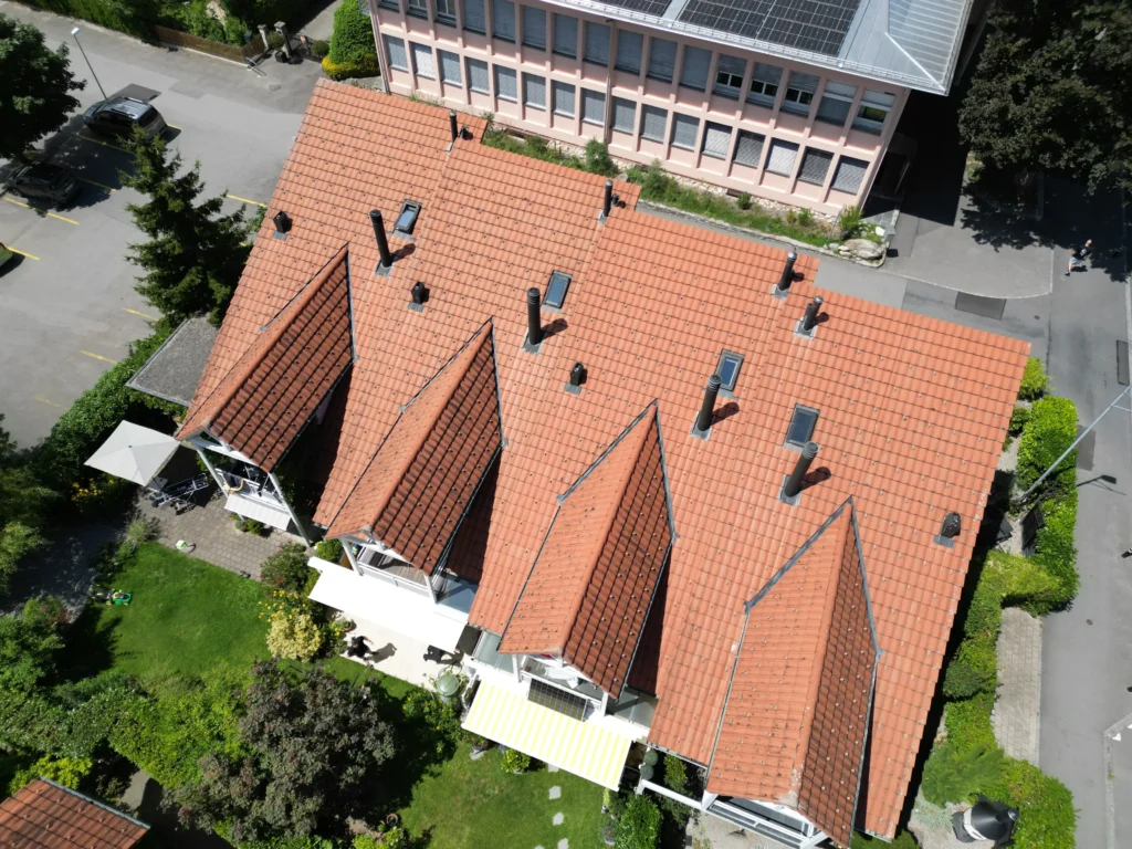

Manual roof measurement leaves critical detail out.
On steep or hard-to-reach roofs, area, pitch and obstruction data cannot be captured with the same confidence on every surface. That uncertainty forces an extra verification step before solar site survey work can move into design.

Roof area alone does not show the usable surface.
Total square metres is not a decision-grade number. Pitch, parapets, chimneys, HVAC units and other obstructions all reduce the surface that can actually carry modules.

Layout and quoting run separately from measurement.
When measurement, module layout and proposal preparation live in different tools, figures are re-entered and fall out of date. Every PV project then carries extra verification and coordination work.
WORKFLOW
From drone imagery to a priced proposal, in one project flow.
Run 3D roof measurement, solar panel layout and reporting on a single model.
-
01
Upload your drone imagery
Start the roof project with photos you captured yourself.
-
02
Review the 3D roof model
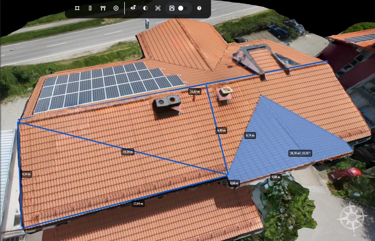
Assess area, pitch, distance and obstructions directly on the model.
-
03
Prepare the panel layout
Select the usable surfaces and build the solar panel layout.
-
04
Generate reports and quotes
Produce the technical report, and a priced proposal report when you need one.
3D ROOF MEASUREMENT
See roof surfaces, pitch and obstructions in a single 3D model.
Render-a is drone roof measurement software: it converts imagery you captured into project data. Review roof area, pitch and obstruction information in one view before the panel layout begins.
- Measure roof area and pitchAssess roof surfaces and pitch in a structured way for PV project preparation.
- Spot obstructions earlySee chimneys, parapets, skylights and HVAC units before you place a single module.
- Select the usable surfacesIdentify the roof surfaces suitable for solar panel layout on the same 3D model.
SOLAR PANEL LAYOUT
Select usable roof surfaces and prepare the panel layout.
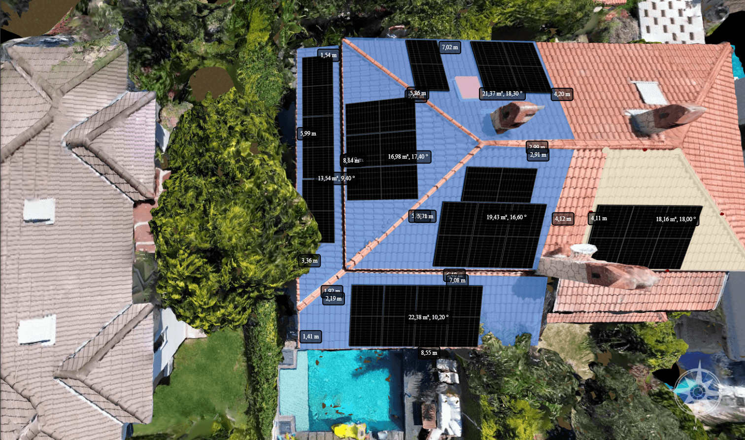
Choose the suitable surfaces on the 3D roof model and build the solar panel layout without leaving the project context.
- Select suitable roof surfaces Identify the surfaces usable for module placement, accounting for pitch, area and rooftop obstructions.
- Review the layout on the model Check the panel layout on the same 3D roof model and assess project detail more clearly.
- Move on to reporting Carry roof measurement and layout data into the technical report and priced proposal step.
PROJECT OUTPUTS
From measurement to report, your project outputs in one place.
Manage everything you need across drone roof measurement, solar panel layout and reporting in the same project flow.
- 01
Measurable 3D roof model
A three-dimensional roof model for reviewing area, pitch, distance and project detail.
- 02
Technical report and export
Export the information needed for roof measurement and project review as PDF, CAD (DXF), OBJ and PV*SOL-compatible files.
- 03
Priced proposal report
Add your own panel, inverter and material catalogues with your prices to build a priced proposal report. See the solar proposal solution.
Start with your own drone imagery.
Create a free 3D modelFrequently Asked Questions
Rendera creates georeferenced 3D roof models that allow precise calculation of slope, azimuth, surface area, and complex geometries. When GPS-enabled drone imagery is used, accuracy is typically within millimeter precision. Non-georeferenced inputs such as phone images are also supported, but they provide only relative measurements without a guaranteed scale.
Yes. The generated models provide a detailed digital twin of the roof that can be used to document conditions, identify repair areas, and prepare material takeoffs. This reduces the need for physical site visits and improves safety for inspection teams.
Rendera is focused on geometric and spatial accuracy. It does not perform structural or thermal simulations, but its exported datasets are compatible with engineering tools that can carry out these analyses.
Rendera supports any aerial platform capable of capturing high-resolution imagery. For engineering-grade outputs, drones equipped with RTK or PPK GPS modules, as well as LiDAR payloads, are recommended.
Yes, the data provided by Rendera contains the essential technical information required for PV system installation:
Roof slope and orientation (azimuth)
Usable area and metrics
Obstacle detection (chimney, parapet, air conditioning units, etc.)
Shading analysis (hourly and seasonal)
3D model and orthophoto
PVsyst/PVSOL compatible outputs
This data is sufficient for installation companies to perform system design, panel placement, inverter selection, and cost calculation. Professional companies like Lion Solar Solutions use these technical documentations to prepare customized quotes and initiate the installation process. This ensures a seamless and reliable process from measurement to installation.
Learning how to measure a roof with a drone is simpler than it sounds. Render-a streamlines it into three steps:
Capture: fly a standard drone and take overlapping aerial images.
Process: upload the data to Render-a to generate a to-scale 3D roof model.
Design: export slope, area and obstruction data straight into your solar design and proposal workflow.
The 3D model, orthophoto and measurement data export as PDF, CAD (DXF), OBJ and PV*SOL-compatible files. The technical report and the priced proposal report are produced as PDF.