
High-Precision 3D Land Surveying & Terrain Modeling
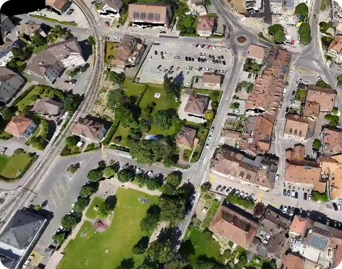
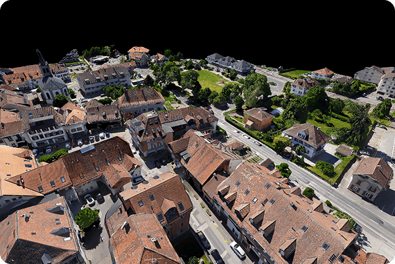
Render-A transforms traditional fieldwork into a digital advantage. We provide engineering-grade 3D land surveying services that also serve as a comprehensive 3D property survey for real estate and development projects. By using advanced drone photogrammetry, we capture every boundary detail, structure, and terrain feature, creating a reliable digital twin foundation for your design and feasibility studies
We collect imagery by drone land surveying and turn it into a reliable 3D terrain model with photogrammetry. Your land survey becomes more than numbers. Slope, elevation changes, aspect, access roads, and environmental features are visible at a glance.
From city centers to hard-to-reach zones, building placement and ground-mount PV layout are planned to match site conditions. Shading impacts are predicted in advance. All deliverables are compatible with CAD, GIS, PVsyst, and PVSOL.
Problems
Scale Discrepancies in Utility-Scale Solar & Infrastructure
In utility-scale solar farms and large-scale infrastructure, a 1% error in slope or coordinate alignment can lead to massive construction delays. Without high-precision land survey data, row spacing and cable routing fail to match the real-world terrain, causing expensive site revisits and structural rework.
Geometric Blind Spots in Urban Planning & Earthworks
Using outdated or non-integrated topographic maps is a financial risk for urban developers and civil engineers. Precise drone land measurement is critical to identify micro-topography, hidden structures, and exact elevation changes. Failing to model these features results in inaccurate volumetric estimations and unforeseen obstacles during excavation.
The Safety & Accessibility Gap: Monitoring Dynamic Sites
Manual crews often cannot access hazardous areas like steep slopes, marshes, or restricted zones, leaving dangerous “data gaps” in your land survey. Furthermore, traditional methods are too slow for frequent updates. Without the speed of drone land surveying software, you rely on static, outdated maps as your site evolves, leading to catastrophic safety risks and mismanaged project timelines.
Optimizing Land Survey Drone Cost & 3D Modeling Efficiency
Render-A transforms the traditional process into a unified workflow: from raw data directly to layout. By deploying autonomous aerial systems, we carry 3D land survey data into a precise model, covering up to 50 hectares per day. This speed significantly reduces your operational land survey drone cost while delivering millions of data points (Point Cloud) for a fraction of the traditional expense.
The result is a streamlined process where uncertainty drops, shading errors shrink, and unnecessary site revisits are minimized offering a highly competitive drone survey price structure without compromising engineering quality.
Unified data in one coordinate system
With drone photogrammetry, Render-a merges orthophotos, point clouds, DSM or DTM, and contours in a single coordinate frame. Land survey data becomes consistent. Micro-topography, slope, and aspect maps are clarified, reducing siting and quantity errors.
Complete coverage in hard to reach areas
Smart flight plans capture critical zones, including steep slopes, slippery ground, and limited access areas. Roads, streams, trees, and structures appear in the 3D terrain model. Measurement gaps close, extra site walks decline, and risks are reduced.
Accurate planning for layout and shading
Sun-path simulation computes row spacing, offsets, equipment locations, and cable routes that fit the terrain. Outputs integrate with CAD, GIS, PVsyst, and PVSOL. Shading-driven deviations decrease, and design decisions move faster.
F.A.Q
Rendera generates digital terrain models (DTM) and digital surface models (DSM). These enable slope mapping, elevation profiling, volumetric estimations, and obstruction analysis. Such outputs are essential for solar farm planning, civil works, and large-scale construction.
Yes. Rendera is designed to handle high-volume datasets. Processing time increases with image count, but there is no strict project size limitation. For very large datasets, users may divide them into manageable segments without losing continuity.
The platform provides elevation adjusted layouts and slope-based analysis, allowing precise positioning of PV arrays, cable routing, and infrastructure placement. Models can be exported to PV simulation tools such as PVsyst and PVSol for energy yield studies.
Yes. Rendera’s land modeling engine is also relevant to agriculture, construction, and real estate. Models can be exported in formats compatible with CAD environments.