
Model and Measure Any Building Exterior with Drone Facade Inspection
Bypass the hassle of manual scaffolding. Render-a’s scaffold-free drone facade inspection creates measurable 3D models of complex building envelopes. Instantly extract critical facade measurements for windows, doors, and cladding with millimeter precision.
Problems
The Scaffolding & Access Bottleneck
Relying on manual work at height requires expensive scaffolds that actually block surfaces from accurate facade measurement. This incomplete data extends your schedules, inflates project costs, and creates massive safety and budget uncertainty.
Perspective Drift & Geometry Errors
Manual methods and oblique photos severely distort true surface geometry. Without high-precision drone facade inspection, critical metrics like azimuth, tilt, and edge lengths drift causing layouts to fail, cladding cuts to miss, and anchor points to slip on-site.
Scattered Data & Broken Workflows
Relying on a mix of photos, hand sketches, and manual notes means your data never aligns on a single, reliable 3D base. This fractured information weakens your CAD and BIM integration, forcing endless design revisions and driving up expensive on-site rework.
The Scaffold-Free Solution for Precision Facade Measurement
Turn simple drone photos into your most powerful measurement tool. Traditional scaffolding is a slow, dangerous bottleneck. By switching to Render-a’s digital workflow, you generate a true to scale 3D facade model in hours. You capture every window, edge, and surface area remotely, securing flawless facade measurements. The result? You plan your layout, order materials, and export directly to CAD eliminating the delays and safety hazards of manual labor.
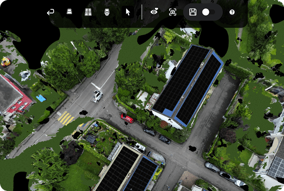
Facade survey without scaffolding
Eliminate the massive costs and safety risks of manual access. With our scaffold-free drone facade inspection, you capture every complex surface remotely and instantly. You gain complete building coverage without ever renting a scaffold or putting a single worker at risk.
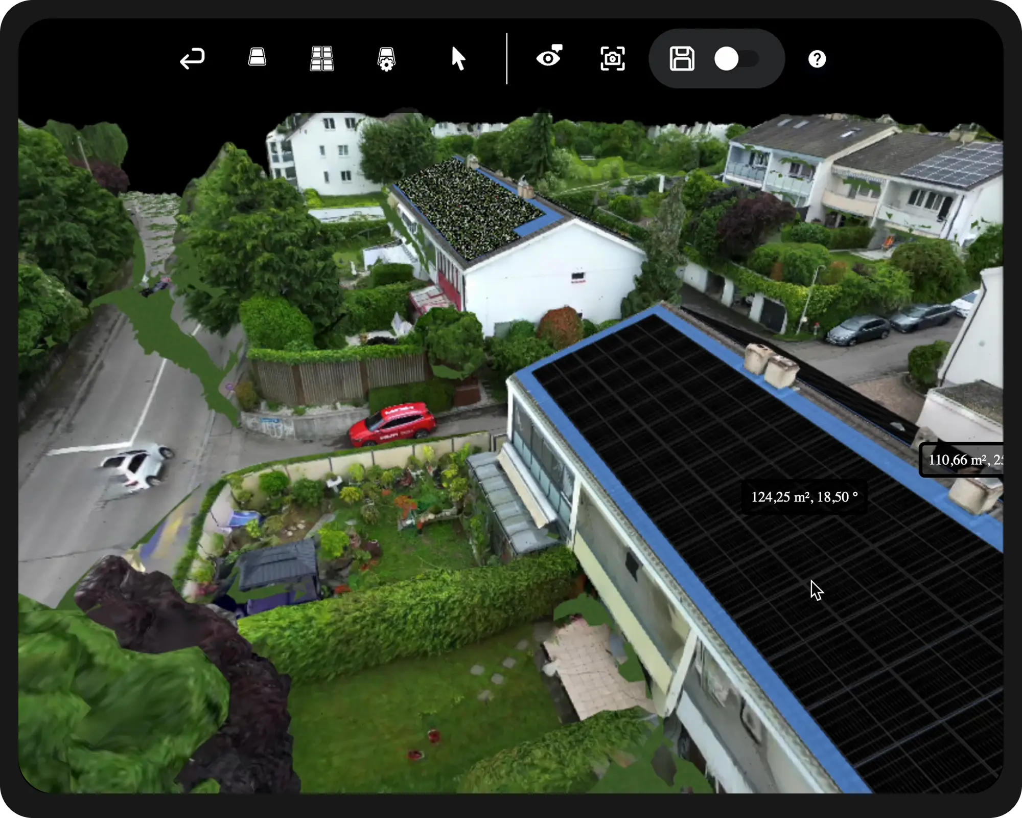
Millimeter-Accurate Facade Measurements
Doors, windows, projections, and edge allowances are extracted at true 1:1 scale. You secure precise facade measurements that prevent costly alignment and angle errors at the very start of your project.
Build-Ready BIPV & Cladding Plans
Move directly from digital survey to flawless execution. Exact material quantities, cut lists, and installation sequences are locked in during planning. Your facade cladding and solar workflows progress faster, with zero on-site surprises and drastically fewer revisions.
F.A.Q
Rendera produces 3D facade meshes with measurable dimensions that allow accurate extraction of wall height, window-to-wall ratios, and alignment deviations. These datasets are suitable for renovation planning, cladding estimation, and envelope assessments.
Yes. High resolution meshes allow visual identification of cracks, misalignments, and material irregularities. Rendera is not a structural health monitoring tool, but its models can serve as reliable inputs for specialized software.
Rendera provides dimensionally accurate models that allow engineers to calculate surface coverage, anchoring points, and material quantities before on-site work begins. This reduces design errors and streamlines procurement processes.
No. Rendera also supports ground-based photography. However, drone imagery provides superior coverage and scaling accuracy. For high rise buildings, UAV based capture is strongly recommended.