
In the fast moving world of 3D roof measurement , renewable energy, accuracy isn’t just a nice to have it’s a financial necessity. When every millimeter of a rooftop can influence solar yield, relying on traditional measuring tools no longer makes sense. The combination of , aerial surveying, and photogrammetry survey has transformed how engineers, architects, and solar professionals approach site assessment and project planning.
Today, we’re diving deep into how this shift is saving time, cutting costs, and paving the way for smarter solar installations.
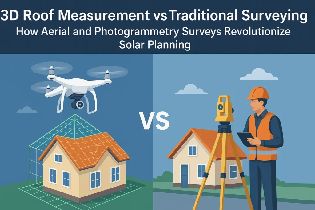
The Limitations of Traditional Surveying
Traditional surveying methods have been the backbone of measurement for decades. They involve manual tools such as total stations or laser scanners operated by field teams. While reliable in small scale construction, these approaches are time intensive and prone to human error.
For solar projects, these downsides quickly add up:
- Time: A single project can require days of manual measurement and data transfer.
- Cost: Skilled labor and equipment usage raise operational expenses.
- Risk: Any missed angle or misalignment can lead to incorrect system placement, resulting in lower energy yield.
In short, manual surveying often lacks the scalability and precision modern solar projects demand. That’s where 3D roof measurement steps in powered by drones and advanced photogrammetry techniques.
Aerial Surveying: Seeing More, Doing Less
Aerial surveying uses drone technology to capture high-resolution imagery and topographic data from above. Unlike ground based survey tools, drones can scan an entire property in a fraction of the time. The data they collect includes roof slopes, obstructions, and even nearby shading elements such as trees or structures.
What makes aerial surveying so effective for solar projects is its combination of speed, safety, and precision:
- Surveys can be completed in hours rather than days.
- No need for ladders, scaffolding, or risky roof access.
- Drones collect consistent data across large areas with centimeter-level accuracy.
For solar design teams, this means having trustworthy data faster and being able to move to modeling and simulation phases without delays.
Photogrammetry Surveys: Turning Images into 3D Intelligence
The real magic happens when aerial imagery meets data science. A photogrammetry survey transforms hundreds of overlapping drone images into precise 3D models. This process, using triangulation and point cloud reconstruction, creates digital twins of rooftops or terrains.
From these 3D models, solar designers can:
- Analyze roof angles and obstructions automatically.
- Optimize panel layout for maximum irradiance.
- Simulate shading throughout the year.
- Generate accurate bills of material and installation plans.
Essentially, photogrammetry translates visuals into geometry the foundation of reliable solar design.
Why 3D Roof Measurement Is a Game-Changer
In solar planning, a 3D roof measurement isn’t just data it’s actionable insight. When integrated with CAD or solar simulation tools, these measurements help predict real world performance and improve investment accuracy.
Key benefits include:
- Precision: Achieve 1, 3 cm accuracy, eliminating costly rework.
- Scalability: One drone operator can handle multiple sites per day.
- Data depth: Beyond roof shape, models capture terrain, shadows, and obstructions.
- Compatibility: Direct export to design platforms for layout optimization.
For a growing number of installers, 3D measurement has become the cornerstone of cost-efficient and high-yield solar design.
From Data to Design: The Importance of Smart Planning
Collecting accurate data is only the beginning. What truly defines a project’s success is how that data is used.
A drone can show you every ridge, valley, and shadow but only intelligent planning turns that information into energy efficiency. Every panel’s tilt, orientation, and spacing must align perfectly with both geometry and sunlight patterns.
That’s why professional solar planning platforms like PVSOL or advanced modeling services are essential. They take 3D measurement data and simulate system performance, ensuring that every kilowatt is optimized before installation begins.
This is exactly where Lion Solar Services comes in. Their team combines cutting-edge modeling tools with years of solar design experience, bridging the gap between measurement and execution. By integrating precise 3D roof measurement and photogrammetry survey data into smart design workflows, Lion Solar ensures each solar project performs as intended from the first blueprint to the final connection.
How Rendera Fits Into the Workflow
At Rendera, we believe accuracy should be both accessible and scalable. Our 3D modeling and visualization services transform drone captured data into digital assets that solar engineers can trust.
When your aerial surveying data passes through Rendera’s modeling pipeline:
- It’s processed into high-fidelity 3D meshes and roof outlines.
- Irregularities are cleaned, scaled, and aligned with real world coordinates.
- You receive ready to use models compatible with PV simulation and structural software.
This means no more manual CAD drafting, no more guesswork just seamless transition from drone data to solar design. Rendera’s process helps project teams save time, minimize measurement errors, and accelerate installation planning.
Beyond Measurement: Toward a Smarter Solar Future
As renewable energy adoption accelerates, the line between measurement and modeling continues to blur. The next generation of solar professionals isn’t just collecting data they’re interpreting it through AI-assisted design and simulation.
By adopting 3D roof measurement, aerial surveying, and photogrammetry survey technologies, project teams gain a unified source of truth. Every stage from feasibility studies to installation benefits from the same accurate digital foundation.
And when integrated with professional planning solutions such as Lion Solar’s PVSol based services and Rendera’s in-house modeling capabilities, you get the perfect balance: precision, efficiency, and scalability.
Traditional surveying had its era, but data driven solar design demands modern tools. Aerial and photogrammetry based 3D roof measurement not only improves accuracy but also transforms how projects are planned, priced, and executed.
By combining Rendera’s 3D modeling power with Lion Solar’s expert planning, you can bridge the gap between drone data and solar reality achieving better designs, faster timelines, and optimized system yields.
Ready to take your next solar project to the next dimension?
Explore Rendera’s 3D services to see how we turn measurement into meaning.
For more updates, success stories, and solar innovations connect with us on LinkedIn. Let’s build a brighter, smarter, and more precisely measured future together.


