
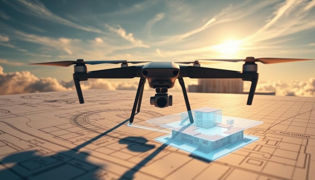
Rooftop work is the most dangerous part of photovoltaic (PV) installations. The industry is now using drones for precise data collection, avoiding the risks of site visits. Companies like Lion Solar Solutions are improving PVSOL design accuracy with drone technology and Render-a’s 3D modeling and measurement services.
This method not only increases accuracy but also lowers labor risks, setting a new benchmark in solar engineering. By incorporating drone data into PVSOL design software, the process becomes more efficient and dependable.
Key Takeaways
- Drones reduce labor risk in PV installations by eliminating the need for rooftop visits.
- Render-a’s 3D modeling and measurement services enhance the accuracy of PVSOL designs.
- The integration of drone technology with PVSOL design software improves the efficiency and reliability of photovoltaic system design.
- This approach sets a new standard in solar engineering by maximizing accuracy and reducing labor liability.
- The use of drones and Render-a’s services represents a significant advancement in solar design software capabilities.
The Dangerous Reality of Traditional Solar Site Assessments
Traditional solar site assessments pose significant risks. They often require personnel to climb rooftops, leading to falls and injuries.
Workplace Injury Statistics in Solar Installation
The solar industry has seen a rise in workplace injuries. Falls from heights during assessments and installations are a major cause. Recent statistics show a concerning rate of serious injuries in the solar sector.
Financial Impact of Rooftop Accidents
Rooftop accidents pose a threat to lives and have a significant financial impact on solar companies.
Direct Costs: Medical and Compensation
Direct costs include medical expenses and compensation claims for injured workers. These costs can be substantial, affecting a company’s bottom line.
Indirect Costs: Project Delays and Reputation
Indirect costs, such as project delays and damage to a company’s reputation, can be equally detrimental. Delays can lead to lost revenue and increased project costs.
Advanced technologies like pv software and renewable energy software can mitigate these risks. They reduce the need for physical site assessments.
How Drone Technology Revolutionizes PV Site Safety
The integration of drone technology in solar site assessments has transformed the industry. It significantly enhances safety protocols. Traditional methods often involve manual measurements and roof access, posing hazards to workers.
Eliminating the Need for Roof Access
Drones with high-resolution cameras and sensors capture detailed data without roof access. This reduces workplace accidents and injuries.
Comprehensive Data Collection from Safe Distances
By flying over the site, drones collect data from safe distances. This reduces worker exposure to hazards. The data helps create accurate 3D models for precise solar project planning.
Weather and Environmental Risk Reduction
Drones can operate in various weather conditions, though some may affect their operation. They minimize worker exposure to harsh weather or environmental hazards during site assessments.
Seasonal Considerations for UK Solar Projects
In the UK, drones offer a flexible solution for solar site assessments across different seasons. The table below summarizes the advantages of using drones during different UK seasons:
By leveraging drone technology, solar project planners can enhance site safety. They improve data accuracy and streamline the planning process, regardless of the season.
PVSOL Design Fundamentals and Measurement Requirements
High-precision 3D measurement data is transforming PVSOL design fundamentals. It provides accurate inputs for photovoltaic system design and solar energy simulation. This is key for optimizing pv system optimization and ensuring solar installation efficiency.
Critical Parameters for Accurate Solar Modeling
Accurate solar modeling in PVSOL demands precise data on several critical parameters. These include:
- Roof dimensions and orientation
- Shading analysis requirements
Roof Dimensions and Orientation
Accurate measurements of roof dimensions and orientation are vital. They determine the optimal placement of solar panels. This ensures the PVSOL design maximizes energy production, reducing losses from shading and misalignment.
Shading Analysis Requirements
Shading analysis is essential for identifying obstructions that could affect solar panel performance. High-precision 3D data enables detailed shading analysis. This allows for more accurate PVSOL modeling and optimization.
Limitations of Manual Measurement Methods
Manual measurement methods for data on roof dimensions, orientation, and shading analysis are slow and error-prone. Drone-based 3D measurement techniques offer a more efficient and accurate solution. They significantly enhance PVSOL design accuracy and reliability.
Step-by-Step Guide to Drone-Based Data Collection for PVSOL
Drone technology is transforming the solar industry by boosting accuracy and safety. This guide will show you how to use drones for precise 3D measurements in PVSOL projects.
Pre-Flight Planning and Preparation
Thorough planning is key before flying. It involves evaluating the site and mapping out the flight path.
Site Assessment and Flight Path Design
Conducting a detailed site assessment is critical. It helps identify obstacles and plan the best flight path. This ensures the drone captures all needed data safely.
Regulatory Compliance in UK Airspace
It’s essential to understand and follow UK airspace rules. This includes getting the right permissions and sticking to flight restrictions.
Executing the Data Collection Flight
The flight involves guiding the drone along the planned path. It captures high-resolution images or video for 3D models.
Post-Flight Data Management
After flying, the data is processed to create accurate 3D models. This includes photogrammetry and point cloud generation.
By following this guide, solar designers can use drones for data collection in PVSOL. This improves the accuracy and efficiency of their designs.
Converting Drone Imagery to PVSOL-Compatible 3D Models
Transforming drone imagery into 3D models for PVSOL is a game-changer for solar design. It allows for unmatched precision in project execution.
Photogrammetry Processing Techniques
Photogrammetry is key to turning drone shots into 3D models. It works by analyzing images that overlap to build detailed 3D site models.
Point Cloud Generation and Refinement
The first step in photogrammetry is creating a point cloud. This is a collection of 3D data points. Next, these points are refined to remove errors and ensure precision.
Creating Accurate Surface Models
After refining the point cloud, accurate surface models are developed. These models are vital for PVSOL design. They provide the topography needed for solar panel placement.
Handling Complex Roof Structures
Complex roofs are a challenge in 3D modeling. Advanced photogrammetry software overcomes this by using multiple viewpoints and high-resolution images.
Ensuring Measurement Accuracy
To ensure accuracy, the 3D model must be validated against known points. This step confirms the model’s accuracy in representing the site’s real conditions.
Insurance Benefits and Risk Management Advantages
Drone technology in PVSOL design boosts accuracy and offers substantial insurance benefits. It minimizes the need for personnel to access rooftops and dangerous areas. This reduces the risk of workplace accidents significantly.
Reduced Liability Insurance Premiums
Companies with fewer on-site accidents see lower liability insurance premiums. This decrease is due to the lower risk profile from drone-based data collection. It’s used for solar panel layout and pv system optimization.
Enhanced Documentation for Claims Prevention
Drones capture detailed, high-resolution imagery and 3D models. These serve as thorough documentation of site conditions before, during, and after project completion. Such detailed documentation can greatly lower the chance of insurance claims for pre-existing damage.
Client Confidence and Project Approval
The accuracy and detail from drone surveys boost client confidence. Solar designers can share precise data on site conditions. This helps in clearly communicating project details, timelines, and risks. It streamlines the project approval process.
Drone use in PVSOL design offers more than just data collection. It strengthens a robust risk management strategy and improves insurance terms. Key benefits include:
- Reduced on-site risks
- Lower insurance premiums
- Enhanced documentation
- Increased client confidence
Lion Solar Solutions’ Implementation of 3D Measurement Data
Lion Solar Solutions has transformed its design process by incorporating 3D measurement data into its PVSOL workflows. This move has greatly improved the precision of their solar energy simulations.
Integration with Design Workflows
The company has smoothly integrated 3D measurement data into its PV software. This allows for more accurate designs. Lion Solar Solutions can now create detailed models that accurately reflect site conditions.
Quality Control Processes
Lion Solar Solutions has established strict quality control processes. These ensure the accuracy of the 3D measurement data. The company thoroughly checks the data collected and the designs created using PVSOL.
Measurement Accuracy Verification
To confirm measurement accuracy, Lion Solar Solutions regularly compares 3D measurement data with actual site conditions. This verification process guarantees that solar energy simulations are both reliable and accurate.
Maximizing PVSOL Design Accuracy with Drone Data
Accurate PVSOL design requires precise data, which drones can provide. Drone-captured 3D models significantly improve photovoltaic system design accuracy.
Importing 3D Models into PVSOL
To use drone data in PVSOL, start by importing 3D models from drone images. This step involves several key considerations.
File Format Considerations
The 3D model’s file format is essential for PVSOL compatibility. Formats like OBJ and STL are directly importable into the software.
Resolution and Detail Requirements
The model’s resolution and detail are critical for accurate design. Higher resolution models offer more detailed surface information. This allows for precise panel placement and shading analysis.
Optimizing Panel Placement with Precise Measurements
Accurate 3D models enable designers to optimize panel placement for maximum energy production. Precise measurements help identify the best solar panel locations. This considers tilt, orientation, and spacing.
Shading Analysis Improvements
Drone data enhances shading analysis by providing detailed shading object information. This allows designers to reduce shading losses and enhance system performance.
Integrating drone data into PVSOL design leads to more accurate and efficient photovoltaic systems. This results in better project outcomes.
Render-a’s Specialized Drone Services for Solar Designers
Render-a is transforming the solar industry with its innovative drone services designed for solar designers. They use advanced drone technology to offer detailed solutions for solar project planning. This enhances the precision of 3D measurements significantly.
Equipment and Technology Stack
Render-a employs top-of-the-line drones with high-resolution cameras and sensors to gather precise data for solar design. Their technology includes advanced photogrammetry software. This software transforms aerial images into accurate 3D models.

Data Processing Methodology
Render-a’s data processing involves complex algorithms to create exact 3D models from drone images. This method ensures the data’s accuracy and reliability. It’s perfect for use in renewable energy software like PVSOL.
Delivery Formats and Timelines
Render-a offers their data in formats that work with leading solar design software. Their efficient process guarantees projects are delivered on time.
PVSOL-Specific Deliverables
For PVSOL users, Render-a provides 3D models that can be easily imported into the software. This makes the design process smoother. It also boosts the accuracy of solar panel placement and shading analysis. This improvement enhances the efficiency of solar project planning.
Case Studies: Successful UK Solar Projects Using Drone Measurements
In the UK, solar developers are embracing drone technology to enhance their projects. This move has significantly improved solar panel layouts and pv system optimizations. It’s a cost-effective strategy that’s gaining traction.
Residential Installation Accuracy Improvements
Drone measurements have revolutionized residential solar installations. They provide precise data for solar energy simulations. This precision ensures solar panels are placed for maximum energy output.
Commercial Project Risk Reduction
Drone-based measurements have also reduced risks in commercial projects. They eliminate the need for physical site visits, lowering injury risks and costs. This approach is safer and more cost-efficient.
Utility-Scale Implementation Benefits
Utility-scale solar projects have seen design accuracy and timeline improvements with drone technology. Drones enable faster data collection and processing. This speeds up project timelines.
Cost Savings Analysis
An in-depth cost analysis reveals drone-based measurements save a lot. They reduce manual site assessments and errors, leading to overall cost savings. This is a significant advantage for developers.
Timeline Acceleration
Drone technology has also accelerated project timelines. Rapid data collection and processing allow for quicker design and implementation. This means projects can go live sooner.
Overcoming Common Challenges in Drone-Based Solar Design
Drone-based solar design encounters several hurdles that must be tackled for successful project completion. Despite drones’ benefits in safety and precision, specific obstacles need to be overcome. This ensures their full utilization in solar project planning.
Weather Limitations in the UK Climate
The UK’s weather unpredictability is a major hurdle for drone operations. Cloudy skies and strong winds often disrupt flights, impacting data collection. To address this, scheduling flights during the best weather conditions and employing weather-resistant drones is essential.
Complex Site Handling Techniques
Complex sites, like those with varied roof planes or blocked areas, necessitate unique handling. Advanced flight planning and the application of sophisticated drone software are key. They enable the capture of detailed data in difficult environments.
Data Processing for Challenging Roof Types
Dealing with data from complex roof types, including historic and modern structures, requires meticulous attention.
Historic Buildings and Conservation Areas
When it comes to historic buildings, it’s vital to balance data collection with preservation needs. Employing non-intrusive drone technology is a way to achieve this balance.
Modern Architectural Complexities
Modern buildings often have complex geometries that demand advanced data processing. Using photogrammetry software designed for such complexities can improve the accuracy of 3D measurements for PVSOL design.
By tackling these challenges, drone-based solar design can achieve greater precision and efficiency. This ultimately benefits solar project planning and execution.
Future of Solar Design: AI-Enhanced PVSOL Modeling
The solar design landscape is evolving rapidly, thanks to AI-enhanced PVSOL modeling. This innovation promises to transform the solar energy field. It aims to enhance the precision and effectiveness of solar panel system design.
Automated Feature Detection Advancements
AI algorithms are being developed to automatically detect features relevant to solar panel installation. This includes roof geometry, obstacles, and shading elements. This automation significantly reduces the time and manual effort required for site assessment and design.
Machine Learning for Performance Prediction
Machine learning models are being integrated into PVSOL to predict the performance of solar energy systems under various conditions. These predictions enable designers to optimize system configurations for maximum energy production.
Integration with Smart Energy Systems
AI-enhanced PVSOL modeling is also facilitating the integration of solar energy systems with smart energy grids. This integration allows for real-time monitoring and optimization of energy distribution. It enhances overall system efficiency.
Elevating Solar Design Safety and Precision
The fusion of drone technology with PVSOL design has transformed the solar sector, boosting both safety and precision. By using 3D measurement data from drones, solar designers can craft more precise models. This reduces the necessity for on-site visits, lowering the risks tied to rooftop assessments.
Render-a’s specialized drone services offer solar experts access to high-quality, PVSOL compatible 3D models. This streamlines their design processes, leading to better project results. Whether tackling residential, commercial, or utility-scale projects, integrating drone-based 3D measurement data greatly improves PVSOL designs.
To discover how Render-a’s drone services can enhance your solar design endeavors, visit our website. Or follow us on social media to keep abreast of the latest advancements in solar design software and drone technology.
Linkedin: https://www.linkedin.com/company/render-a/


