
Precise Planning Starts with Accurate Data
Every successful solar energy project whether it’s an industrial rooftop installation or a 50-hectare open-field site – depends on the quality of its data foundation.
Tools like PVSOL is excellent for simulating yields, analyzing shading, and developing optimal layouts.
But when the input data is incomplete or inconsistent, even the best software can produce unreliable results.
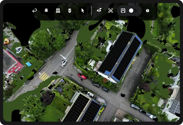
That’s where Rendera comes in offering precise 3D modelling and measurement solutions based on drone imagery and geospatial data. Rendera delivers consistent, detailed digital environments that allow solar planners to work faster and more confidently.
Learn more about Rendera’s 3D analysis services
Why 3D Modelling Matters in Solar Energy Planning
3D modelling is much more than a visual enhancement it’s the foundation for technically sound and economically efficient solar design.
In PVSOL Premium, you can import 3D models and combine them with exact tilt angles, distances, and shading data to simulate realistic energy performance.
This saves time and prevents costly rework:
- Shading areas are identified with real accuracy
- Cable routes and inverter positions can be defined early
- The final layout is directly usable for construction
Rendera ensures that the 3D data you import into PVSOL is consistent, precise, and measurable so engineers, designers, and procurement teams all work from the same reliable data base.
Common Problems Without Reliable 3D Data
Many solar projects still rely on scattered data sources: 2D drawings, manual measurements, old maps, or inconsistent imagery.
This leads to:
- Incorrect roof angles and azimuths
- Incomplete shading analysis
- Time-consuming manual corrections
- Misalignment between design teams
Even the most advanced software like PVSOL can’t compensate for poor-quality inputs.
Rendera solves this by generating a unified 3D model from drone imagery, CAD, GIS, or existing survey data ensuring a consistent base for every simulation.
Rendera + PVSOL: The Perfect Pair for Accurate 3D Modelling
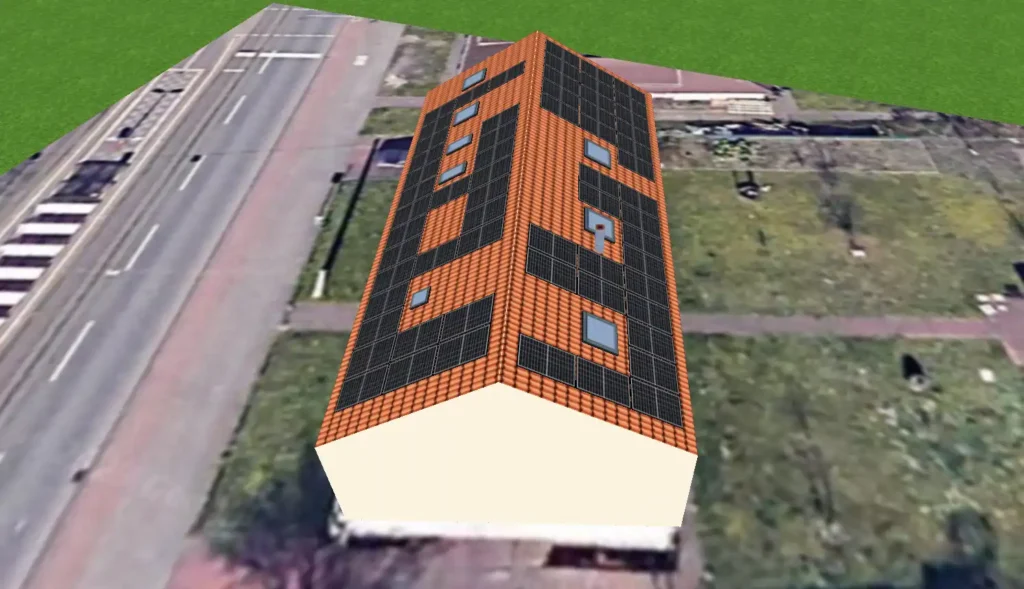
Rendera transforms real world environments into precise 3D models ready to be used in PVSOL.
Our process is straightforward and built for planners:
- Data Capture & Processing
Rendera processes drone images and other available spatial data to build a detailed, true to scale 3D model of your site. - Measurement & Analysis
The 3D model allows for precise measurements of roof pitch, orientation, surface area, and distances forming a solid base for PVSOL simulations. - Solar-Specific Evaluation
Accurate shading visualization and spatial clarity make it easier to define module placement, inverter positions, and maintenance routes. - Export & Integration with PVSOL
The 3D model can be exported in standard formats compatible with PVSOL , enabling smooth simulation and project coordination.
Benefits Throughout the Project Lifecycle
Pre-Sales & Feasibility
Gain reliable insights in days instead of weeks (“Yes / No / How many kWp?”).
Rendera models accelerate the feasibility process within PVSOL.
Design & Planning
Accurate measurements and realistic shading data make layouts precise and transparent.
Procurement & Logistics
Exact component quantities reduce over-ordering and minimize costly errors.
Construction & Commissioning
Fewer on-site plan changes, consistent documentation, smoother acceptance.
Operation & Repowering
Digital 3D twins make repowering and future system expansions easier and faster.
3D Modelling with or without Drone Data Your Choice
Rendera uses drone imagery whenever it’s valuable for instance, when mapping complex rooftops or large solar parks.
However, 3D models can also be generated from existing CAD or GIS data, making Rendera flexible even when no drone flight is possible.
The result:
Always a precise, consistent, and PVSOL ready 3D model that saves time and reduces risk.
Request a 3D data quality check with Rendera
Conclusion: Rendera Brings Accuracy to Your PVSOL 3D Modelling
Whether you use PVSOL,
Rendera provides the 3D data foundation that makes your solar energy design faster, more reliable, and easier to manage.
From drone based modelling to precise geometric analysis Rendera delivers the clarity you need to plan with confidence.
Get started with Rendera and plan your next solar project with precision
Or follow us on LinkedIn for insights, updates, and best practices on 3D modelling, solar energy, and digital site analysis.


