

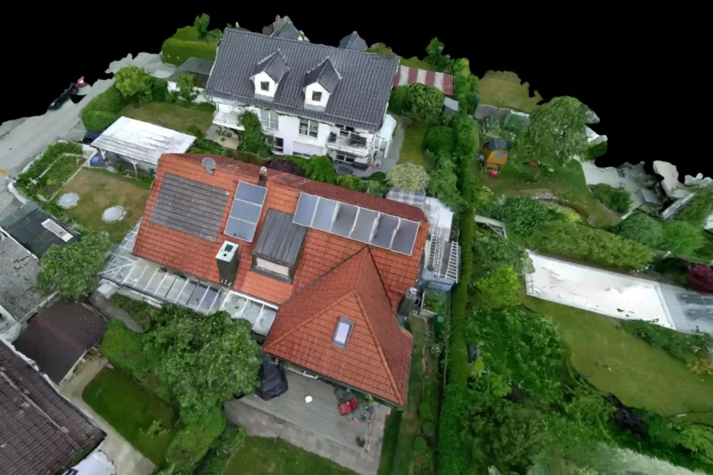
When it comes to solar installation, photovoltaic feasibility, and engineering grade planning, accuracy is not just a preference it is a requirement. General-purpose mapping tools like Google Earth offer a broad, visual understanding of topography, but they are not designed to meet the precision needed for solar project development. This is where Render-a emerges as the next-generation platform, delivering real-time 3D modeling, terrain accuracy, and professional engineering tools specifically optimized for renewable energy projects.
In a world where solar adoption is accelerating, developers, EPC companies, and engineers need more than just satellite imagery. They need high-precision data, detailed terrain modeling, and instant feasibility analysis to reduce costs, eliminate risk, and speed up project deployment. This article explores how Render-a sets a new industry standard in solar engineering, and why it is rapidly becoming the preferred platform for installation planning, design optimization, and feasibility studies.
Why Accuracy Matters in Solar Planning
Every solar project begins with one critical question: Is this location feasible? Determining feasibility depends on several factors such as terrain elevation, shadow simulation, panel angle optimization, and real world obstructions. A single degree of miscalculation can lead to significant production loss over the system’s lifetime.
- Google Earth offers visual scale but does not calculate installation performance.
- Render-a delivers engineering grade precision designed specifically for solar professionals.
Core factors influencing solar project success:
- Terrain elevation and slope
- Sunlight exposure across the year
- Installation design for maximum photovoltaic yield
- Engineering validation and compliance
Render-a integrates all of these directly into its platform in real time.
Google Earth: A Visualization Tool, Not an Engineering Platform
Google Earth is excellent for exploring the planet. It provides a global view of landscapes and urban areas. But when it comes to solar engineering, it lacks several essential capabilities:
- No built-in feasibility calculation
- No 3D photovoltaic simulation
- No real-time terrain deformation or shadow analysis
- Limited accuracy for installation-scale projects
Google Earth functions as a starting point, while Render-a functions as the complete solution.
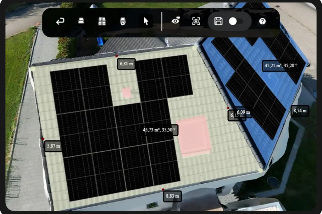
Render-a: Purpose-Built for Solar Engineering Success
Render-a does not simply display terrain it analyzes it, simulates it, and optimizes it. It is engineered for professionals who need immediate answers to critical questions like:
- Where should panels be installed for maximum efficiency?
- How does topography affect photovoltaic output?
- What is the exact feasibility of this location?
Solar Feasibility: From Weeks to Minutes
Render-a’s intelligent feasibility engine analyzes terrain, elevation, and solar potential instantly. What traditionally took engineering teams days of manual calculation is now completed in minutes.
Feasibility with Render-a includes:
- Terrain suitability scoring
- Photovoltaic yield forecasting
- Optimal panel orientation and tilt
- Installation planning with cost estimation
Unlike generalized tools, Render-a is trained on real-world solar project data, making it capable of delivering high-accuracy projections with professional certainty.
3D Installation Design with Engineering Accuracy
While Google Earth can show a building from a high-level 3D angle, it cannot simulate a solar installation with professional precision. Render-a fills this gap with:
- Real-time 3D modeling
- Dynamic topography interaction
- Auto-placement of photovoltaic panels
- Engineering-compliant layout generation
Engineers can visualize the exact placement of solar panels, evaluate design alternatives, and produce export-ready plans for construction teams and stakeholders.
Planning and Design Optimized for Photovoltaic Efficienc
Render-a’s planning system calculates:
- Best installation angles
- Optimal spacing for maximum sunlight absorption
- Energy output potential based on real terrain
- System performance over 12 months
This level of planning is impossible using static satellite imagery. Render-a’s engineering models deliver precision and clarity that lead to higher returns and reduced risks.
Why the Industry Is Transitioning from Visualization to Engineering Intelligence
Key Drivers:
- Precision is required to secure financing and permits
- Feasibility data must be defensible and engineering certified
- Design efficiency determines profitability
- Real-time simulation is essential to decision-making
Render-a combines all of these elements into a single platform eliminating guesswork and enabling solar companies to accelerate project timelines.
The Future of Solar Engineering Is Render-a
Google Earth helped the world visualize our planet. Render-a is helping us engineer its renewable future. For professionals in solar installation, photovoltaic design, feasibility analysis, and engineering planning, the standard is no longer imagery it’s accuracy.
Render-a empowers the solar industry with:
- Precision
- Feasibility intelligence
- Installation optimization
- Next-generation 3D design capabilities
As the global transition to solar accelerates, Render-a stands as the new benchmark for professional engineering excellence in solar energy.
Ready to experience solar planning with true engineering accuracy?
Render-a transforms feasibility studies into high-yield projects. Book your demo and explore the future of photovoltaic design today.


