The Operational Shift in Solar EPC
In today’s highly competitive solar Engineering, Procurement, and Construction (EPC) market, the operational landscape has fundamentally shifted. For a growing installation company, the most expensive and unpredictable resource is no longer the hardware. Solar panel prices have stabilized globally, and inverter technologies are highly accessible. Today, the single most critical bottleneck is time. Specifically, it is the immense amount of time wasted on repeated site visits just for manual measurement, complex structural assessment, and engineering validation.
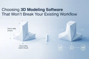
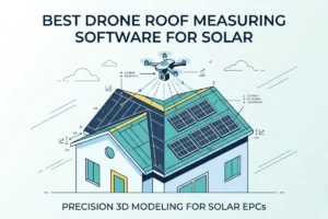
Render-a is the leading solar design software platform engineered specifically for the solar energy sector to solve this exact problem. By automatically generating measurable 3D models from drone imagery, planning precise layouts, and preparing comprehensive analysis reports, it transforms traditional site visits into rapid digital workflows.
Recently, our field team faced a scenario that perfectly illustrates this widespread industry problem and how the right technology completely eliminates it.
The Field Challenge: Cloudy Skies, Wind, and Inaccessible Roofs
We drove 60 kilometers from the city center to reach a remote residential solar site. Upon arrival, the weather conditions were undeniably hostile. It was heavily overcast, the wind was picking up, and a morning rain shower had just passed, leaving all surfaces slick and dangerous.
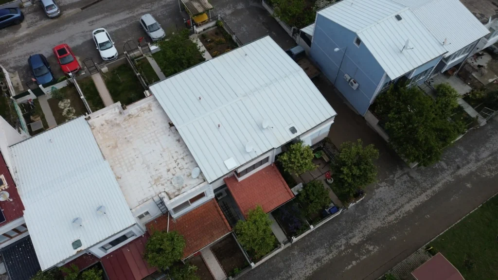
The target property was a large, two-story residential villa featuring a complex, multi-pitched architectural design. Because of the wet conditions, the lack of secure anchor points, and the sheer height of the eaves, the majority of the roof surfaces we needed to assess were physically inaccessible. Climbing up with a ladder and a measuring tape was not just impractical—it was a severe safety violation.
Normally, under these conditions, a standard solar assessment team would face a difficult choice: either abandon the site visit—wasting hours of fuel, engineering wages, and travel time—or attempt a partial, highly inaccurate visual estimate from the ground. Both options lead to flawed project planning, inaccurate quotes, and potential installation disasters down the line.
We didn’t reschedule. We didn’t risk our team’s safety. Instead, we launched the drone.
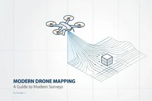
Reimagining Data Collection: 60 Images to Complete Clarity
The physical and geographical barriers of the site were bypassed entirely within moments. Battling the leftover wind gusts, we executed a rapid, automated flight path over the property. With just a single drone flight, we captured 60 high-resolution images from across the entire site. This short flight completed the comprehensive data acquisition phase without a single ladder ever touching the gutters.
When faced with physically restricted or hazardous environments, manual tape-and-ladder methods fail completely. This is exactly why integrating a comprehensive drone roof survey into your daily operations is no longer an optional luxury. It is a fundamental requirement for securing precise structural data and ensuring the physical safety of your assessment teams.
Transforming “Tea Time” into a Real-Time Engineering Workshop
What happened next represents a complete paradigm shift in how solar engineering teams process data and interact with clients using modern solar design software. It highlights the transition from a slow, back-office task to an instant, transparent engineering workflow.
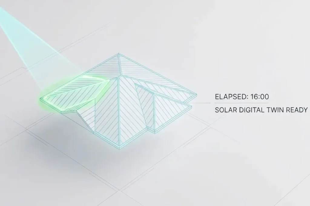
After landing the drone and packing it safely away, the homeowner kindly invited our team inside to escape the cold wind and offered us a cup of tea. While the kettle was boiling in their kitchen, we connected our SD card to our laptop and uploaded the captured drone data directly to Render-a.
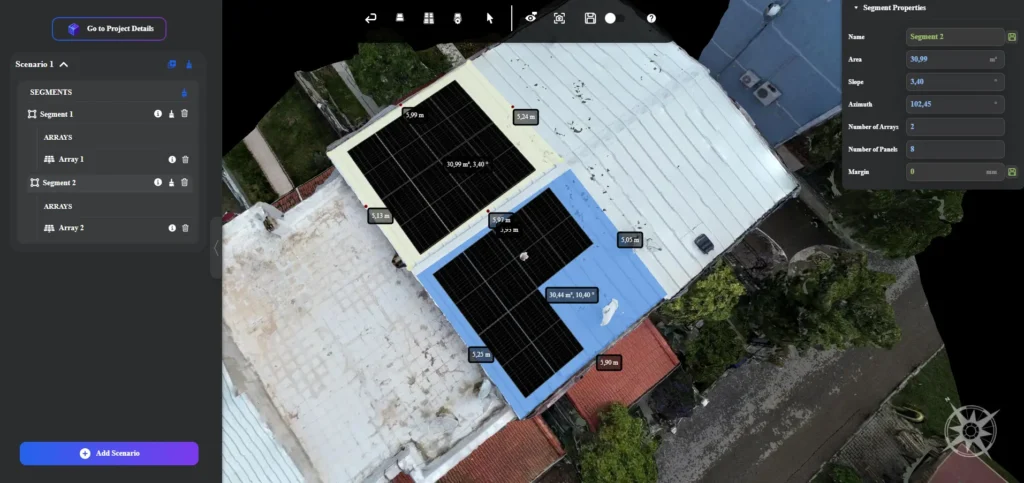
In exactly 16 minutes, a complete, highly accurate 3D digital twin of the homeowner’s villa was ready.
We didn’t have to give the client the standard, frustrating industry line: “Our engineers will analyze this at the office and we’ll get back to you with a quote next week.” Instead, standing right next to the homeowner in their kitchen, holding our tea, we initiated the entire design, validation, and quoting workflow in real-time.
Showing the client exactly how their system is engineered right in front of their eyes builds massive trust. We walked them through the process step-by-step:
- Instant Digital Twin Review: We opened the highly detailed 3D model of their property. The client could visually verify that we weren’t working off assumptions; by modeling with millimeter precision, we had captured the exact, current reality of their home.
- Evaluating Structural Obstacles: We precisely identified chimneys, ventilation pipes, and dormers, mapping them as exclusion zones within the platform to prevent any installation clashes.
- Engineering the Layouts: We mapped out the optimal solar panel layouts right in front of the client. They could see exactly how the system would look aesthetically on their roof, while we ensured maximum energy yield.
- Complex Environmental Data: Instead of guessing the impact of nearby trees or neighboring buildings, the platform ran an automated shading analysis on the 3D model, ensuring our production calculations were based on hard environmental data.
- Preparing the Offer: A technically flawless production report and a ready-to-sign proposal were generated before our tea even got cold.
Operational Scale: From One Missed Opportunity to Four Completed Surveys
The efficiency of this automated workflow had an immediate cascading effect on our operational output. Because the entire assessment from parking the car to completing the 3D layout validation and proposal took less than an hour, we suddenly had the rest of the afternoon free.
Staying in the exact same neighborhood and utilizing the exact same digital workflow, we were able to visit, scan, and process the engineering data and quotes for three additional complex properties on that very same day.
Look at the operational return on investment: If we had relied on traditional manual methods, that initial 60km trip would have resulted in one delayed project and zero usable data due to the wet, inaccessible roof. By utilizing advanced solar design software, that single deployment yielded four comprehensive 3D site surveys and fully validated proposals.
Adapting to Complex Environments: The Future of Solar EPC
This field experience proves that the linear, heavily delayed progression of Site Visit → Manual Measurement → Office Redesign → Proposal Delivery is officially obsolete. By integrating a platform designed specifically for the rigorous demands of the solar sector, EPCs are reducing site survey times by over 90%, eliminating repeated site visits entirely, and preventing the costly human errors associated with manual measurements.
Furthermore, as a solar business scales, the installation environments inevitably become more diverse and challenging. The core technology that allowed us to seamlessly map a two-story villa scales instantly to any commercial or utility-scale challenge. If a project expands to include large ground-mounted arrays across uneven, topographically challenging terrain, the exact same platform facilitates precise 3D land surveying without requiring different software or workflows.
Similarly, as the energy market shifts heavily toward urban environments and multi-story commercial buildings, the platform’s advanced capability to conduct highly detailed facade measurement ensures that vertical surfaces, balconies, and complex building envelopes are captured with the identical speed and precision as a standard flat roof.
Ultimately, the most successful and profitable solar EPCs of the future will be those who refuse to compromise on data accuracy and operational speed. With the right technology in hand, the journey from site, to design, to proposal is now happening in real time.
Ready to Transform Your Engineering Workflow?
Don’t let manual measurements and repeated site visits slow down your growth. Experience firsthand how Render-a can turn complex field data into millimeter-precise 3D models in minutes.
Book a Free Demo today and see how our solar design software can revolutionize your site survey process and scale your solar EPC operations.