

Engineering and earthwork companies routinely invest tens of thousands of dollars in high-end CAD software, volumetric modeling tools, and cloud platforms. Yet, project managers frequently face a frustrating reality on-site: the software-calculated cut-and-fill volumes rarely match the actual fleet payload counts leaving the site.
The issue is almost never the software itself. The root cause is the input data. When a platform is fed interpolated, low-density baseline data from manual ground measurements, even the most sophisticated algorithm yields flawed results. “Garbage in, garbage out” remains an unforgiving rule in civil engineering.
Recently, a project team managing a complex 45-hectare site with steep benches and deep excavations approached Render-a with this exact challenge. Their traditional site surveys were falling behind, halting heavy machinery, and delivering volume estimates with unacceptable margins of error.
Here is how we redesigned their data collection workflow, achieved 98% data accuracy across every terrain layer, and reduced operational surveying costs by 65%.
The Hidden Cost of Traditional Ground Surveys
Surveying heavy earthwork sites or steep terrain using traditional tools such as GNSS rovers or Total Stations presents severe operational bottlenecks:
- Layer Blind Spots & Interpolation Errors: Walking a rough terrain to capture manual points is physically demanding and time-consuming. A field crew might capture a few thousand points across a large site. The software then “guesses” (interpolates) the elevation between those points. This misses micro-topography, sloped benches, and individual excavation layers, leading to massive discrepancies in volume calculations.
- Costly Operational Downtime: For safety reasons, heavy machinery, haul trucks, and excavators must slow down or halt entirely while surveyors are on foot in active zones. Every idle hour eats directly into project margins.
- Safety Hazards: Positioning field personnel on unstable benches, loose rock faces, or near active haul roads creates severe occupational safety risks.
The Render-a Approach: 98% Accuracy Layer by Layer
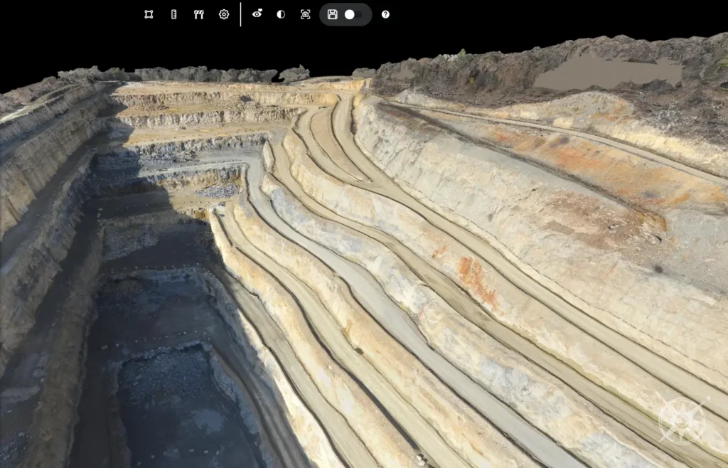
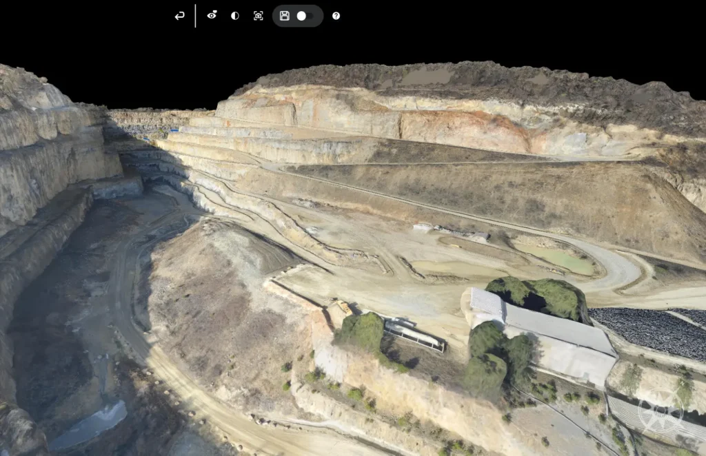
To eliminate guesswork, we deployed industrial RTK-enabled drone systems configured for automated, high-overlap photogrammetric missions. Instead of spending weeks on foot, our team captured the entire 45-hectare site without interrupting site machinery for a single minute.
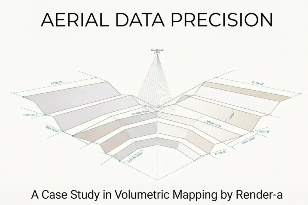
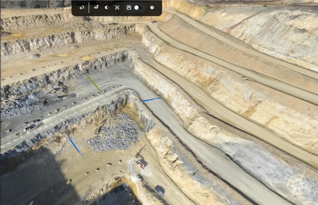
The goal was not merely to produce a high-resolution aerial photo, but to generate a mathematical digital twin of the landscape. Using our specialized 3D land surveying workflow, we processed raw field data into a dense point cloud consisting of over 400 million georeferenced points.
This dense dataset allowed site engineers to isolate and measure individual soil and rock layers independently with survey-grade drone accuracy.
Traditional Surveying —–> ~4,500 points captured —–> High Interpolation (Low Accuracy)
Render-a 3D Survey —–> 410,000,000+ points —–> 98% Verified Accuracy (Layer-by-Layer)
By providing a precise surface mesh, the project team could plug true-to-life spatial data directly into their engineering software, ensuring their volume calculations reflected site reality.
Performance Benchmark: Field Comparison
The table below highlights the operational metrics comparing the traditional manual topographic survey against our aerial 3D modeling workflow on the 45-hectare site:
| Metric | Traditional Ground Survey | Render-a 3D Survey | Operational Impact |
| Data Accuracy | Variable (Interpolated) | 98% Verified Precision | Eliminates volumetric errors |
| Layer Isolation | Poor / Blended | 100% Layer-by-Layer Separation | Exact material volume tracking |
| Turnaround Time | ~14 Days | 1.5 Days (Flight + Processing) | 89% Time Reduction |
| Point Density | ~4,500 Points | 410 Million Points | Unmatched surface resolution |
| Site Interruption | High (Machinery paused) | Zero (Complete remote capture) | Uninterrupted productivity |
| Total Cost | High (Labor, time, downtime) | 65% Lower Overall | Immediate ROI |
Expanding Beyond Topography: The Integrated Site Twin
A complex earthwork site rarely exists in isolation. Often, project managers need to evaluate surrounding structures, retaining walls, or adjacent infrastructure alongside the land terrain.
To build a complete digital site model, ground and aerial data can be scaled seamlessly. Combining terrain datasets with high-resolution facade measurement allows engineers to assess structural interfaces, boundary walls, and slope stability near existing buildings without dispatching separate crews.
Conclusion: Precision Data Drives Profitability
A topographic survey shouldn’t be a bottleneck that delays operations or introduces financial risk through flawed volume estimates. As demonstrated in this field deployment, achieving survey-grade drone accuracy is no longer about buying expensive software it is about capturing the right baseline data from day one.
By delivering 98% accuracy with layer-by-layer measurability, Render-a enables engineering teams to eliminate site downtime, cut surveying costs by 65%, and unlock the true value of their design software.