

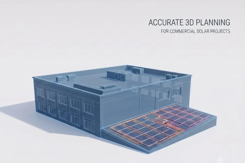
A commercial solar installer we worked with used to build concept designs from a satellite image and a site visit checklist. It worked fine until the roof had a mechanical unit nobody flagged, a parapet wall that ate three rows of panels, or a section of shading from a neighboring building that only showed up once the crew was already on site with racking in hand. Every one of those surprises meant a redesign, a delayed proposal, or worse, a change order after the client had already signed.
That’s the quiet failure point in a lot of solar projects. The concept design looks solid on paper because it’s built on incomplete information, and incomplete information doesn’t announce itself until installation is already underway.
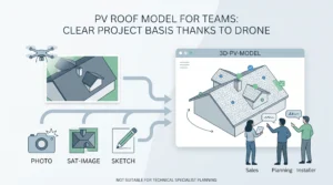
3D solar planning and concept design exists to close that gap before it becomes expensive. Instead of estimating a roof or a parcel from a flat image, the design starts from an actual model of the site, built from drone data, and everything that follows, panel count, shading analysis, string layout, gets built on something real.
Why Concept Design Breaks Down Without Accurate 3D Data
Most concept design problems trace back to the same root cause: the design team is working from a partial picture. A satellite image shows the roof outline but not its pitch. A site visit checklist captures a handful of measurements but not the full geometry. Shading gets estimated from general sun-path software rather than the actual obstructions on that specific roof.
The result shows up later, and later is always more expensive than earlier. A panel layout that assumed a clear roof plane has to be redrawn once a rooftop unit is discovered. A proposal built on an estimated azimuth has to be revised once the real roof angle is surveyed. Each revision costs design hours, and each one chips away at a client’s confidence in the number they were originally quoted.
What Data Does 3D Solar Planning Start From?
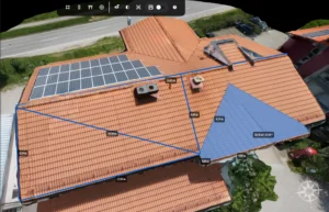
A proper 3D solar concept design starts from a drone-captured model of the actual site, not an estimate of it. That means the roof plane, pitch, obstructions, edges, and surrounding shade sources are all part of the same dataset the design is built on. Render-a’s drone roof survey process is built specifically for this stage: one flight captures the full structure, and the resulting model becomes the single source of truth for everything the design team does next.
What sets this step apart is turnaround. Depending on how many images a flight produces, Render-a typically delivers a finished 3D model in 30 minutes to 3 hours, not the days a manual site visit and redesign cycle can take once a missed detail surfaces. That speed matters less as a convenience and more as a design decision: a design team that gets accurate data back the same day can catch a problem before a proposal ever goes out, instead of after.
From Point Cloud to Concept Design
Once the site is captured, the raw data has to become something a designer can actually work with. This is where a lot of teams still lose time, either because the model isn’t clean enough to trust or because it doesn’t translate cleanly into the software they’re already using for panel layout and yield estimates.
How Does a 3D Model Turn Into a Solar Design?
The model gets exported into standard solar design tools like PV*SOL or PVsyst, where the actual roof geometry, not an approximation of it, drives the panel layout. Because the export carries real measurements and real shading obstructions, the design team can place panels, run string calculations, and estimate yield against the true conditions of the site rather than a simplified version of it. Render-a’s solar proposal preparation workflow is built around exactly this handoff, so the proposal a client sees reflects the roof they actually have.
This is also where the difference between 3D capture methods tends to show up. Plenty of tools can produce a point cloud. Fewer can produce one that’s both accurate enough to trust for panel placement and fast enough to have back before a proposal deadline. Render-a was built around holding both of those at once, since a design team gains little from a highly accurate model that arrives too late to be useful, or a fast one that isn’t precise enough to design against.
A Project Walkthrough: What Changes in Practice
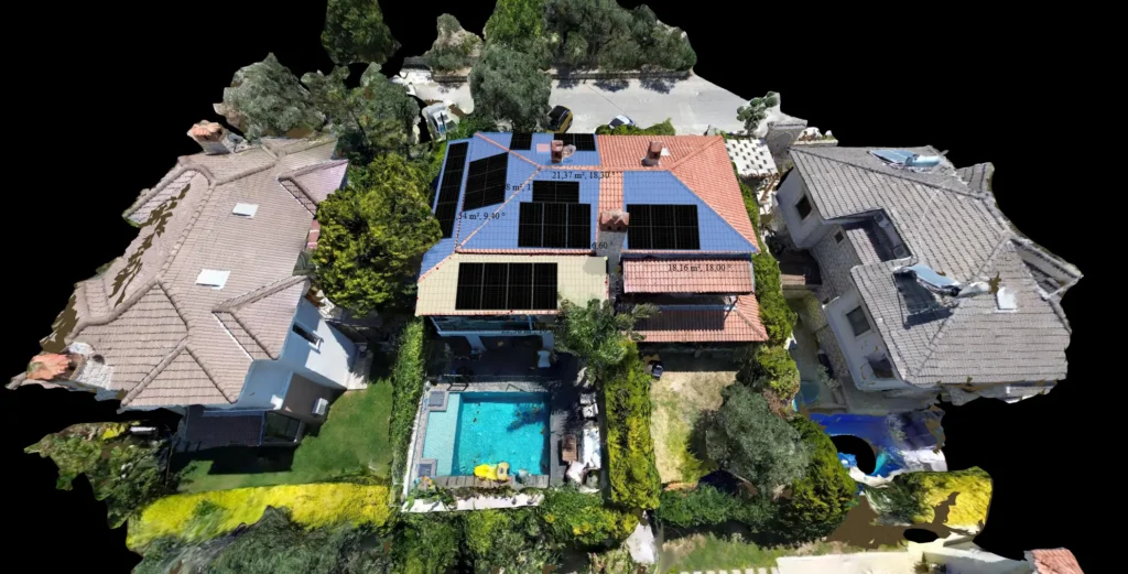
On a recent commercial rooftop project run through Render-a, the original site visit had flagged the roof as mostly clear with two small vents near one edge. A drone-based 3D capture, delivered as a finished model within hours of the flight, told a different story: a rooftop HVAC unit sat almost directly in the middle of what would have been the highest-yield section of the array, and a parapet on the south side cast more shade in winter months than the initial estimate accounted for.
Because that information came in during the concept design phase, not after panels were ordered, the layout was adjusted before the proposal ever reached the client. Panel count shifted slightly, string configuration changed to route around the shaded section, and the final yield estimate was actually more accurate than the first pass, not less. The client received one proposal, not a revised one two weeks later.
That’s the practical value of building concept design on a real 3D model instead of an assumption: the surprises get found during planning, when adjusting a layout costs nothing, instead of during installation, when it costs a crew’s time on a roof.
What Are the Benefits of Concept Design Built on a 3D Model?
- Panel layouts reflect the actual roof geometry, not an estimate of it
- Shading analysis accounts for real obstructions on the roof and nearby structures
- Proposals go out accurate the first time, cutting down on revision cycles
- Installers arrive on site with a layout that already matches what’s actually there
- Clients see a design based on their specific site, which is easier to trust than a generic template
Is 3D Solar Panel Design Only for Rooftop Systems?
No. The same approach applies to ground-mount and utility-scale projects, where site topography, not roof geometry, drives the design. A parcel with uneven grading or drainage patterns needs the same kind of accurate baseline data that a complex rooftop does, just captured across land instead of a building. Our 3D land surveying service supports exactly this use case, giving ground-mount design teams a real terrain model to design against instead of a topographic estimate.
It also extends to building-integrated applications, where solar elements are planned as part of a facade rather than a roof. In those cases, the same principle applies: the design is only as good as the measurement it’s built on, which is why facade-specific projects lean on our facade measurement service rather than treating a vertical surface like a simplified rooftop.
Can 3D Solar Design Prevent Installation Problems Before They Happen?
In most cases, yes. The majority of costly surprises during solar installation trace back to a gap between what the design assumed and what the site actually looks like. When the design starts from an accurate 3D model instead of an estimate, that gap closes before installation ever begins. It doesn’t eliminate every unknown, a site can still change between survey and installation, but it removes the most common and most avoidable source of rework: designing against a roof or a parcel that was never accurately measured in the first place.
If concept designs on your projects keep needing revisions after the fact, the fix usually isn’t a better guess. It’s better data from the start. Get in touch with Render-a to see how a same day 3D model can support your next solar planning phase.