

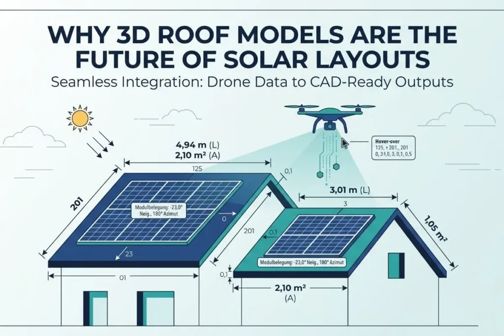
We have spent enough time on job sites to know exactly how a project derails. A design team spends hours drafting a layout based on standard satellite imagery, everything gets approved, and the installation crew shows up. That is usually when someone realizes a newly installed HVAC unit is blocking the primary array, or the parapet wall casts a shadow that wasn’t accounted for.
These blind spots cost time, force emergency redesigns, and eat directly into profit margins.
For a long time, the industry treated drone solar roof measurement software as just a digital tape measure to calculate square footage. But our experience working with solar engineers has shown us that simply measuring a flat area is no longer enough. To actually eliminate installation errors, you don’t just need measurements you need to capture reality.
Here is why moving away from basic flat mapping and adopting real object modeling is becoming the standard for modern PV design.
The End of Flat Mapping: Why 2D Tools Fail on the Job Site
When you rely on standard 2D tools or outdated satellite images, you are essentially guessing. A flat map might give you the rough perimeter of a building, but it completely ignores the depth, pitch, and physical obstructions that define how solar panels will actually sit on that roof.
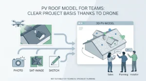
In commercial solar design, the stakes are even higher. Missing a slight pitch variation or failing to account for the height of a chimney means your shading calculations will be off. We saw that teams needed a way to bring the physical roof into the office without losing a single detail. That shift required us to look past basic images and focus on creating flawless 3D roof models.
By turning the actual environment into a digital twin, design teams can see the exact height of every vent pipe, skylight, and AC unit before a single panel is ordered.
Capturing Every Object with Engineering-Grade Photogrammetry
This is where the technology separates itself from consumer-level drone apps. Generating a usable model requires engineering-grade photogrammetry. It is not just about stitching photos together to make a pretty picture; it is about recognizing objects in three-dimensional space.
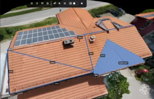
When we process flight data, the engine doesn’t just see a roof. It identifies the spatial relationships of the entire structure. If you need a detailed 3D reconstruction of a complex industrial site, the software maps the parapets, the exact roof angles, and every potential obstruction.
This level of object modeling ensures that when you move to the layout phase, you are dropping panels onto a mathematically perfect representation of the real world. This approach is what makes modern aerial photogrammetry roofing so effective it removes the guesswork entirely.
From Visuals to Action: Streamlining the Layout
Having a great 3D model is only half the battle. The real value for an EPC comes from what you can actually do with that model.
Instead of manually drawing boundaries and calculating setbacks, high-quality accurate roof measurements allow the software to automate the heavy lifting. The system recognizes the geometry, maps out the usable space, and can instantly generate a solar panel layout that avoids the objects we just modeled.
Because the height and shape of every obstacle are already captured, the shading reports are based on reality, not estimations. You know exactly where the shadows will fall at 2:00 PM in December, which means your yield forecasts become something you can actually guarantee to your clients.
Bringing It Together: CAD-Ready Outputs
The biggest bottleneck we see in technical teams is data transfer. It is frustrating to capture amazing drone data, only to find out you have to manually re-trace everything because it won’t import properly into PV*SOL or AutoCAD.
That is why we built our process around CAD-ready outputs. A 3D model is only as good as its ability to talk to your existing engineering tools. By delivering data that drops perfectly into your standard simulators at a 1:1 scale, we close the gap between the drone operator in the field and the engineer at the desk.
Ultimately, the goal isn’t just to fly a drone or take better pictures. The goal is to build an end-to-end solar workflow where field data flows directly into bankable, ready-to-install designs without friction.
Want to see how we handle complex 3D modeling and PV layouts in the real world? Follow our updates and join the conversation on our LinkedIn page.