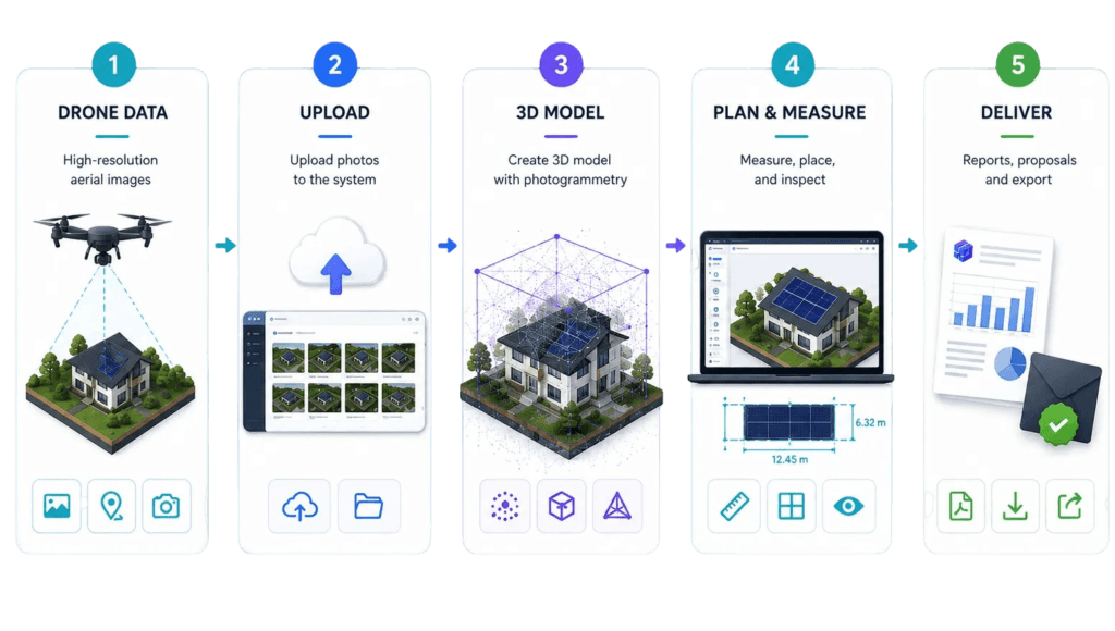


Render-a Technical Reference and Limits,Operations Summary
What the documentation covers and deliberately does not assume: credit use, package structure, support workflow, and a one-page operations summary.
Information Directly Supported in This Document
This version preserves the usage flows, measurement tools, data-capture principles, export formats, credit consumption, and troubleshooting steps from the supplied technical document. Variable product information, such as current package features and the Hyperlapse/video workflow, has been updated to align with Render-a’s public product pages.
Technical Parameters Specifically Not Assumed
| Topic | Approach in this document |
| DIN accuracy class / ±cm tolerance | No specific class or tolerance is guaranteed. |
| CRS / UTM / WGS84 detail | Options not explicitly documented by the product are not listed. |
| Eturnity transfer format | Integration is supported; the exact transfer method should be verified per version. |
| Drone ISO / shutter numeric presets | No single value is recommended across all drone models. |
| Video codec / fps / minimum duration | No fixed value is given, as this depends on the product version. |
Versioning Principle
Render-a is a fast-evolving SaaS product. As a result, packages, interface labels, export options, and some integration details can change. This document keeps core operational principles stable while treating the current in-app screens and product announcements as the primary source of truth.
Support
When reporting an issue, sharing the project name, drone/camera used, approximate photo count, capture conditions, the Preview result, and any error message shortens diagnosis time.
Support: support@render-a.com
Sources
- The supplied Render-a Technical Documentation (30 pages, base source for the 08/07/2026 versioning work).
- Render-a’s official product and sign-up pages reference source for current package features, the Hyperlapse/video workflow, data upload, and platform capabilities.
Note: All illustrations in this document were created originally for this documentation version; no third-party field photos or screenshots were used.
Appendix A – One-Page Operations Summary
| Stage | Minimum check | Successful outcome |
| Plan | Flight path + permits + light | Safe, repeatable capture |
| Capture | Sharpness + ≥75% overlap + coverage | Complete data set |
| Preview | Bounding Box + Show Gaps | Clean data set |
| Render | Status and time tracking | 1:1 3D digital twin |
| Measure | Length/area/pitch/height | Measurable geometry for design |
| Design | Area + panel config + fill tool | Solar layout |
| Export | Target software format | Integration-ready file |
| Report | Yield + finance + carbon + branding | Customer-ready delivery |